
Colton, J. H.
Map. Canada West or Upper Canada.
back
|
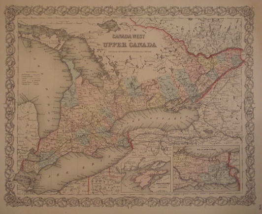
Seller ID: 1289 New York: J. H. Colton & Co., 1855. Sheet (36cm x 44cm), image (32cm x 40cm). Nicely coloured map with decorative borders showing counties and townships of southern Ontario as far north as the French River and west to include Manitoulin Island; large coloured insert showing the Niagara frontier and the Welland Canal, smaller insert showing Wolf Island (Ottawa is still called 'Bytown'), borders high-lighted in colour. A large, attractive, colourful map of pre-Confederation Ontario. Simply mounted on white, acid-free mat. Price: $120.00
For more information or to place your order, you can email us at info@trilliumbooks.ca, telephone us at 705-749-0461, |